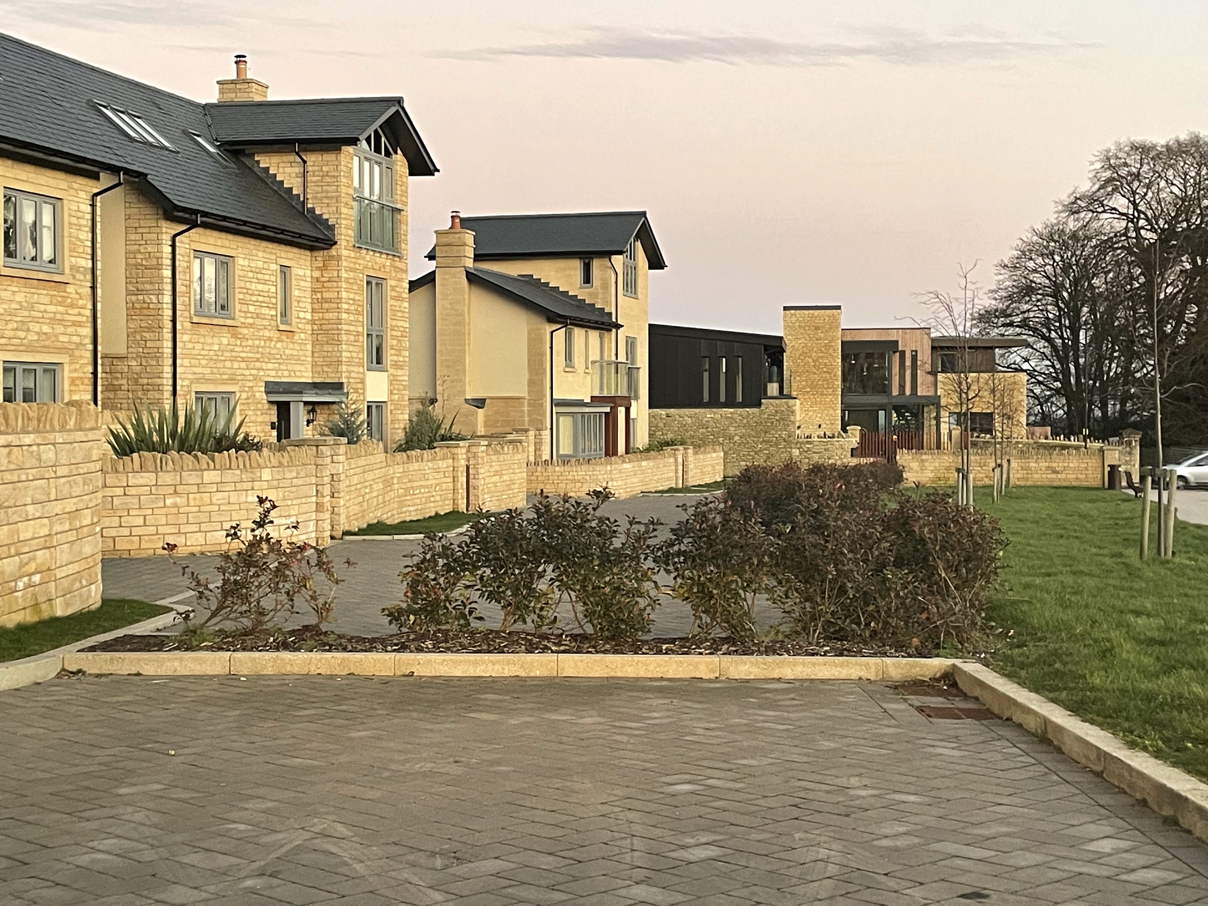
Liveable Neighbourhoods (LNs) have been a topic of great discussion in Bath of late, which seems slightly odd when the first comparable example locally is at least 50 years old. ‘No such thing as a new idea’ as they say. In fact, there are over 100 LNs in Bath that predate the latest trial schemes in Southlands (Weston) and Church St (Widcombe).
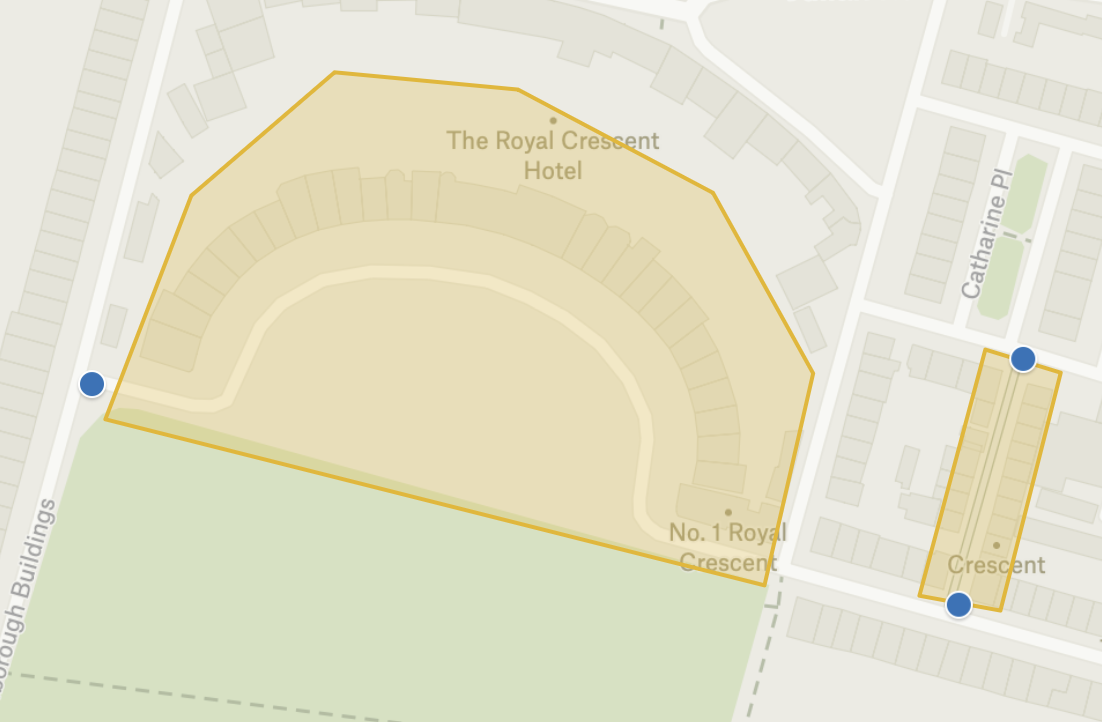
Walk Ride Bath have plotted all the LNs in Bath and surrounding areas on a map. They fall into three categories:
- 100s of developments laid out intentionally as LNs to prevent through traffic (green areas)
- 18 areas where a traffic restrictions have been retrospectively introduced to create LNs (yellow areas)
- 2 new Liveable Neighbourhood Trials (red areas)
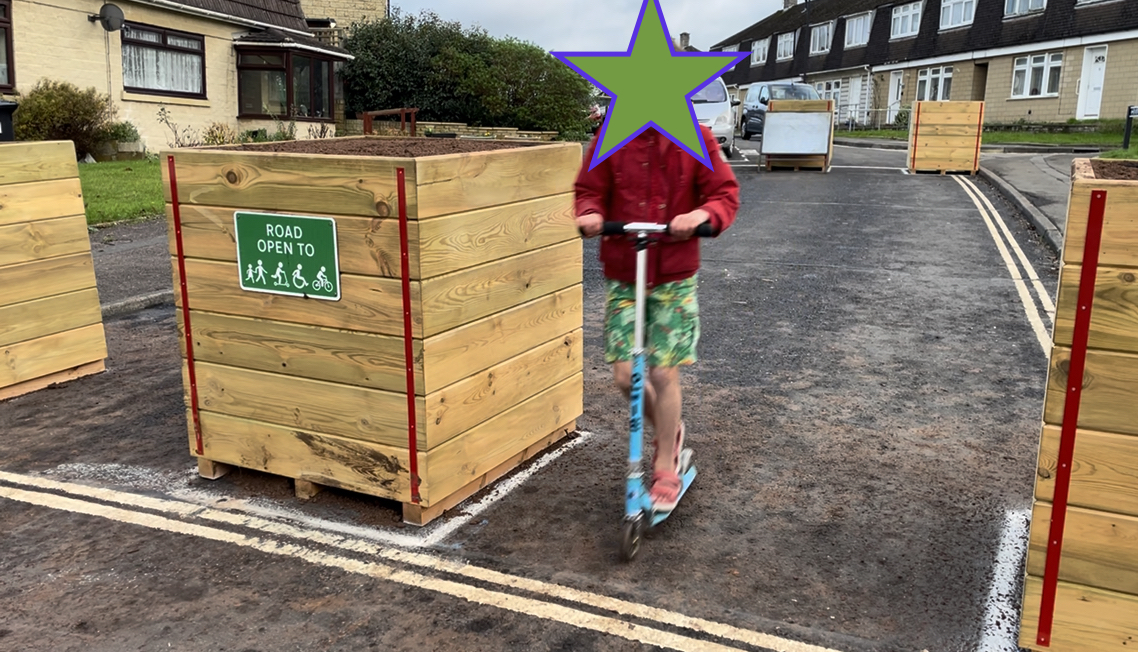
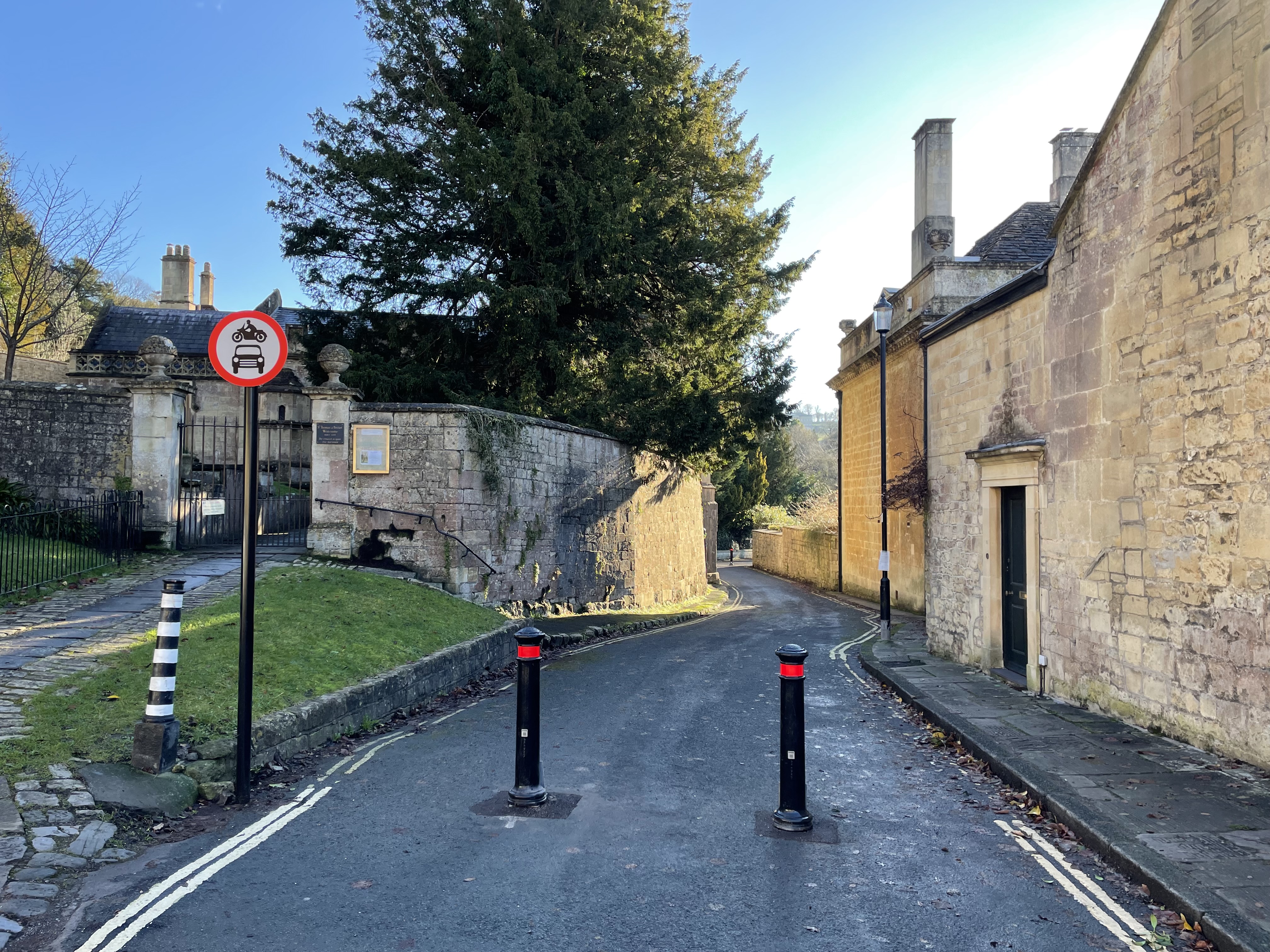
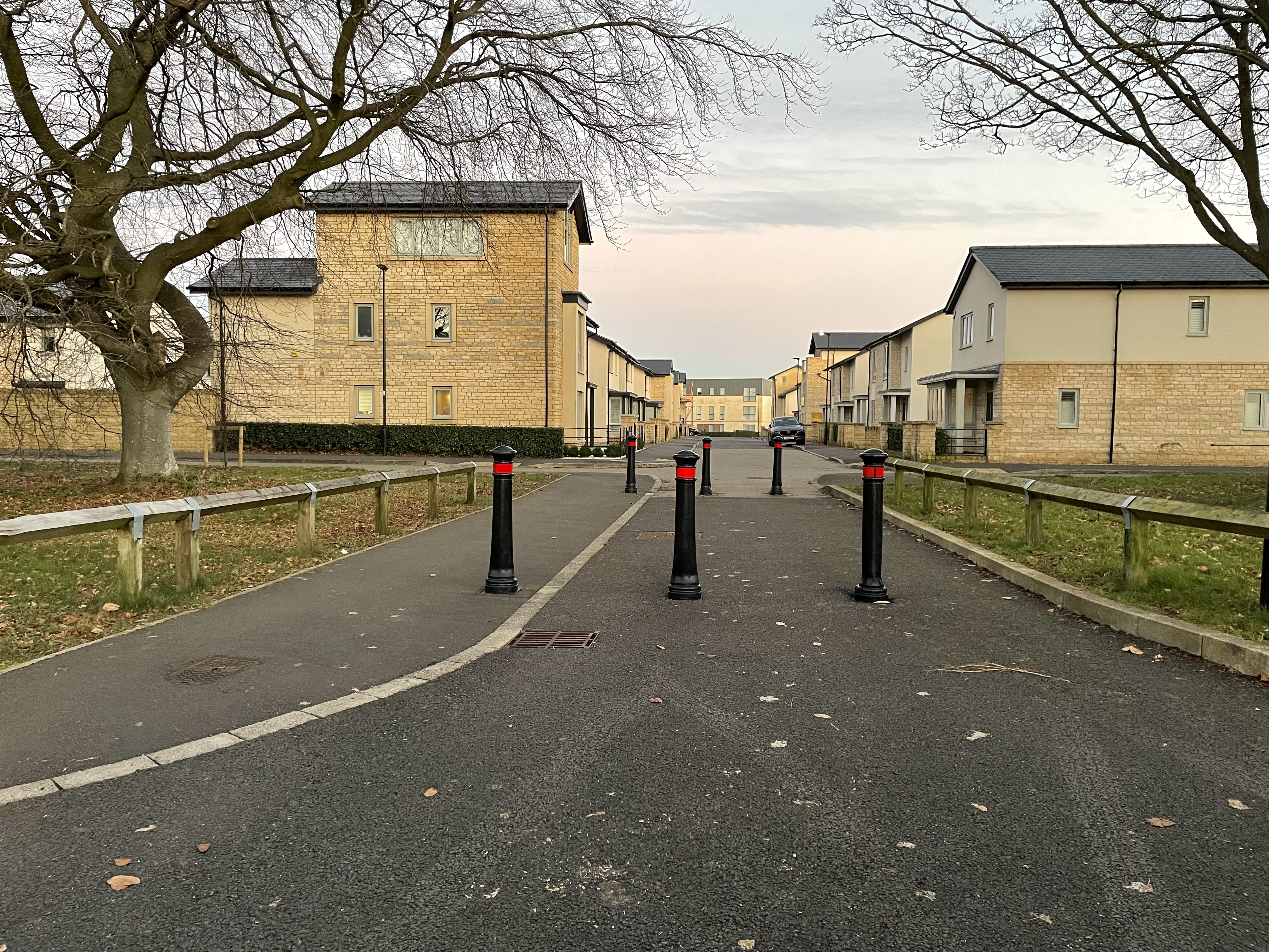
LNs areas often use ‘filters’ (blue dots), so called as they allow some things to pass through e.g. a pedestrian, and other things not, e.g. a vehicle. Filters include bollards, landscaping, bus gates, and planters.

Two things really stand out when looking at the map.
Firstly, we basically stopped developing Bath in a way which accommodated through traffic by the mid 1950s.
Oldfield Park clearly stands out as one of the last big ‘grid’ developments, which is why it remains a labyrinth of through traffic routes. The immediate post war estates like those in Weston, Twerton and Batheaston were still relatively permeable to vehicles, although even in those places there are plenty of loop roads and cul-de-sacs.


By the time the 1960s rolled around, developers very rarely sought to accommodate through traffic. And at exactly the same time we start to see driveways become a standard feature to new houses- the age of the motor vehicle had really begun. And the same thinking continues to this day- a visit to former MOD Ensleigh will show how filters have been quite deliberately to send cars back to the main road.


The second thing that stands out, is how may places have already had filters retrospectively installed- places in Odd Down, Newbridge, Claverton Down, Newbridge, Fox Hill… some have been in place for decades, and in none of these existing LNs have people campaigned to have them removed.


Essentially, people like safe, quiet neighbourhoods.
So – where is your street on the map? Take a look at the map.
(For full disclosure; the author of this article lives in an LN area)


I found an article this week from the Bath Chronicle 25 years ago about the then planned Bus Gate on Orange Grove and the (separate) closure of Milsom Street just for one day for the second international ‘Car Free Day ‘. Traders were up in arms saying that it would lead to the City being “cut in two” and the death of hundreds of shops.. motorists and the police were objecting to the closure of Milsom Street because it would lead to “gridlock”.
We need to take action to tackle the climate emerging and electric cars aren’t the answer. Encouraging people to walk, cycle and use public transport is.
LikeLike
It would be really interesting to have a link to that article. Ironically, roads such as Union Street have some of the highest rents in Bath precisely because with no motor vehicles they provide a great experience for city centre visitors. Many people would probably struggle to point at Union Street on a map- not sure what that tells us!
LikeLike
Please post this on NextDoor – not that it will make much difference to the level of toxic ranting that goes on there. But it would be good to show that it’s not all a LD conspiracy.
LikeLike
Our position is to provide perspectives that people may wish to engage with. But there seems little to be gained from direct social media interactions on this matter.
LikeLike
I made a lengthy comment on this piece that does not seem to have got past moderation. Sorry if it was too nuanced to appear in association with this thread.
LikeLike
I haven’t seen it I am afraid! Nuanced welcome
LikeLike
Hi Guy, this is an interesting way to view Bath. However living on Chaucer Rd in Bear Flat area I do question how this area can be considered an LN. Simply because a road is not arterial doesn’t make an area an LN. Poet’s area bears school traffic and (possibly) those looking at avoid Wellsway queues. Thus it both supports significant traffic and is not an area where operators of vehicles (“drivers”) appear to give consideration to others (nor are they encouraged to do so by any particular planning/ design)
Regards,
James
LikeLike
Good points we need to digest.
LikeLike