If we’re going to have a conversation about cycling in Bath and North East Somerset we need to be able to know where we are starting from and where we want to end up. More importantly we need a way of talking to individual councillors and asking them, what they are doing about “their” patch.
So something that was started as a project at a Bath Hacked “Celebrate the City” hackathon, has very quickly, over the last couple of days, evolved into something rather powerful:

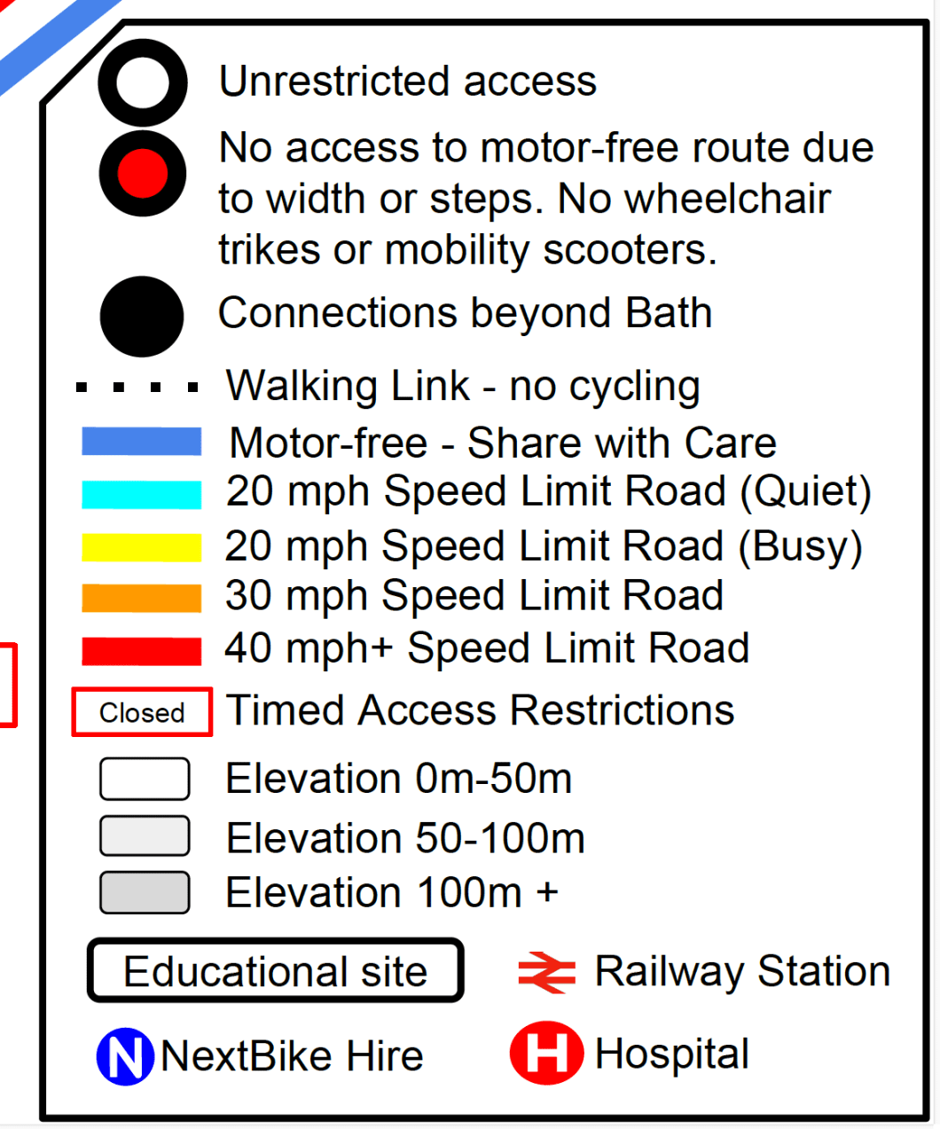
This map informs you about the quality of the route you will encounter if you are on a bike. The key to understanding this map is in the legend:
I hope residents and councillors can look at this map and see the problems that we have in cycling around this city, and more importantly some of the access issues we have for people in wheelchairs and on mobility scooters. I particularly think kids get a raw deal. The whole southern plateau is very very poorly served.
You can download various versions here (Suggest PDF).
The pdf is available here.
We’ve also printed out 5000 of these slightly modified version to be handed out at the Bath Tour of Britain CycleBath stand on Thursday. Please come and get your copy.

If you are interested in how it was made, I even made a video:
