Been a long time coming and the Quays area development is out for consultation.
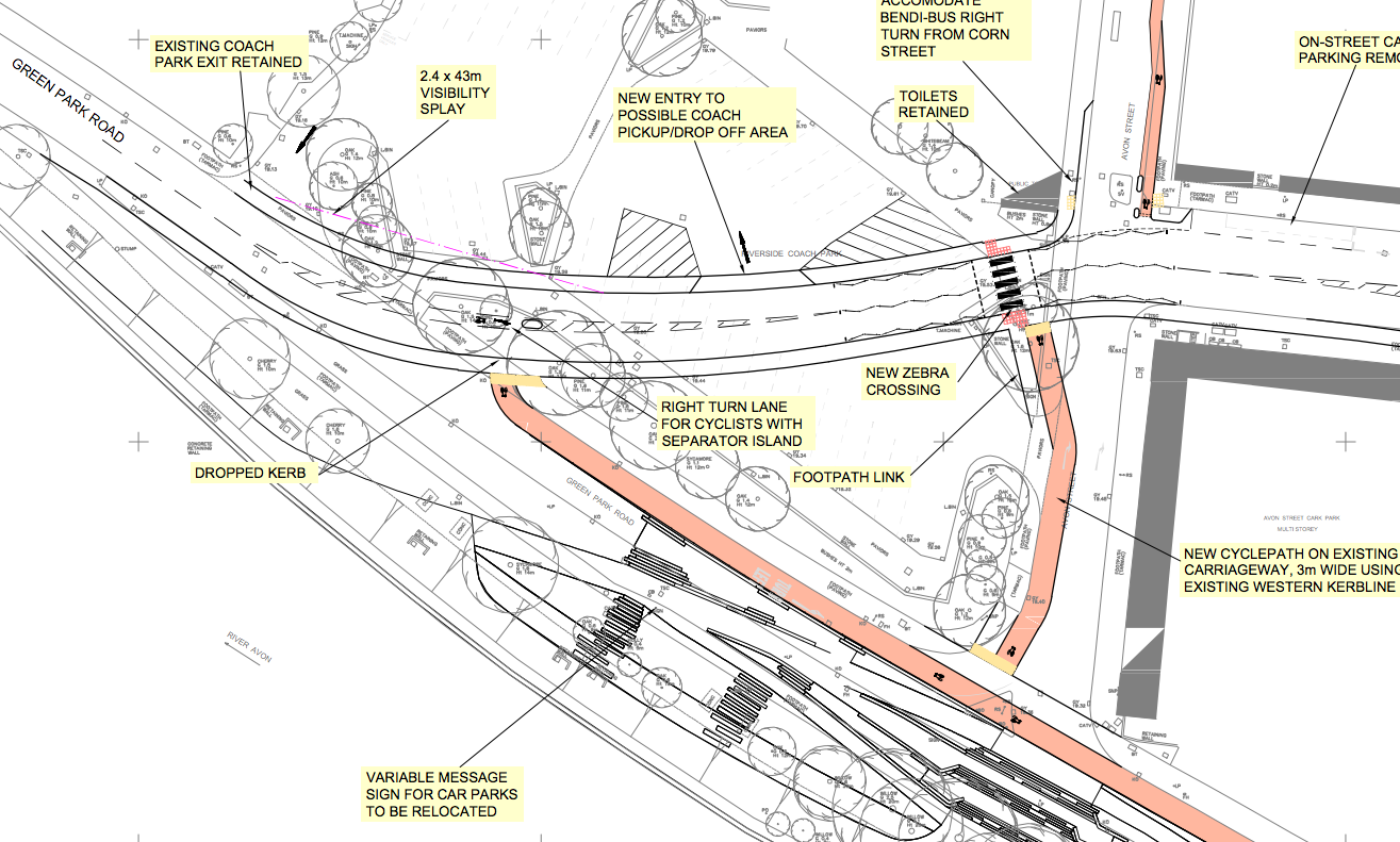
Flood risk mitigation works enabling the development of the Bath Quays to include: Realignment of Green Park Road; Changing Corn Street to be two-way traffic and Ambury to dual-lane; Relocating access points to Avon Street Car Park; Changing the Coach Park to be drop-off and pick-up only; Widen the River Channel in places between Churchill Bridge and Midland Bridge; Replace Riverside ground floor windows and doors at Waterfront House, Camden Mill and Bayer Building; Demolish existing walls and replace with higher walls between Churchill Bridge and Camden Mill; Provision of new flood wall between Bayer Building and Midland Bridge and Realignment of Riverside footpath at Green Park.
Planning application is here
Will need a lot of study but this layout kinda indicates that they have not considered that a MAJOR traffic free cycle route is along the river and is also a major tourist route to the Two Tunnels. They can’t just ‘design’ out what people do because the river path is one of very few traffic free corridors out of Bath.
Throwing cyclists out onto the road on the fast bend down there makes me feel uncomfortable as well.
Go study the files and comment below. I expect a lot of shoutiness 🙂
[edit] I’ve now written up my thoughts on this plan. Go read and remember to follow us!
