Hello! I was reflecting how quiet it seems on the active travel front locally, and decided an update was in order. The WECA election was partly responsible. Also, we are currently in a detailed design phase for many projects, so the main noise is people sharpening pencils at BANES (our council) and WECA (the regional authority)… with a certain amount of ‘rubbing out’ going on too!
Most projects are funded through the City Region Sustainable Transport Settlement (CRSTS) and this money needs to be largely spent by Spring 2027- so under 2 years to go. Not long in infrastructure building terms, so stuff should be happening on the ground soon. You may have noticed in Bristol (for instance) there is ALREADY building going on… to be frank, they have done a better job of getting funding from elsewhere eg. directly from Active Travel England (ATE). In BANES, well… we are where we are. I will run down the main projects I can think of locally (and there is a LOT to keep tabs on), but firstly a word on the bigger picture.
The BIGGER Picture
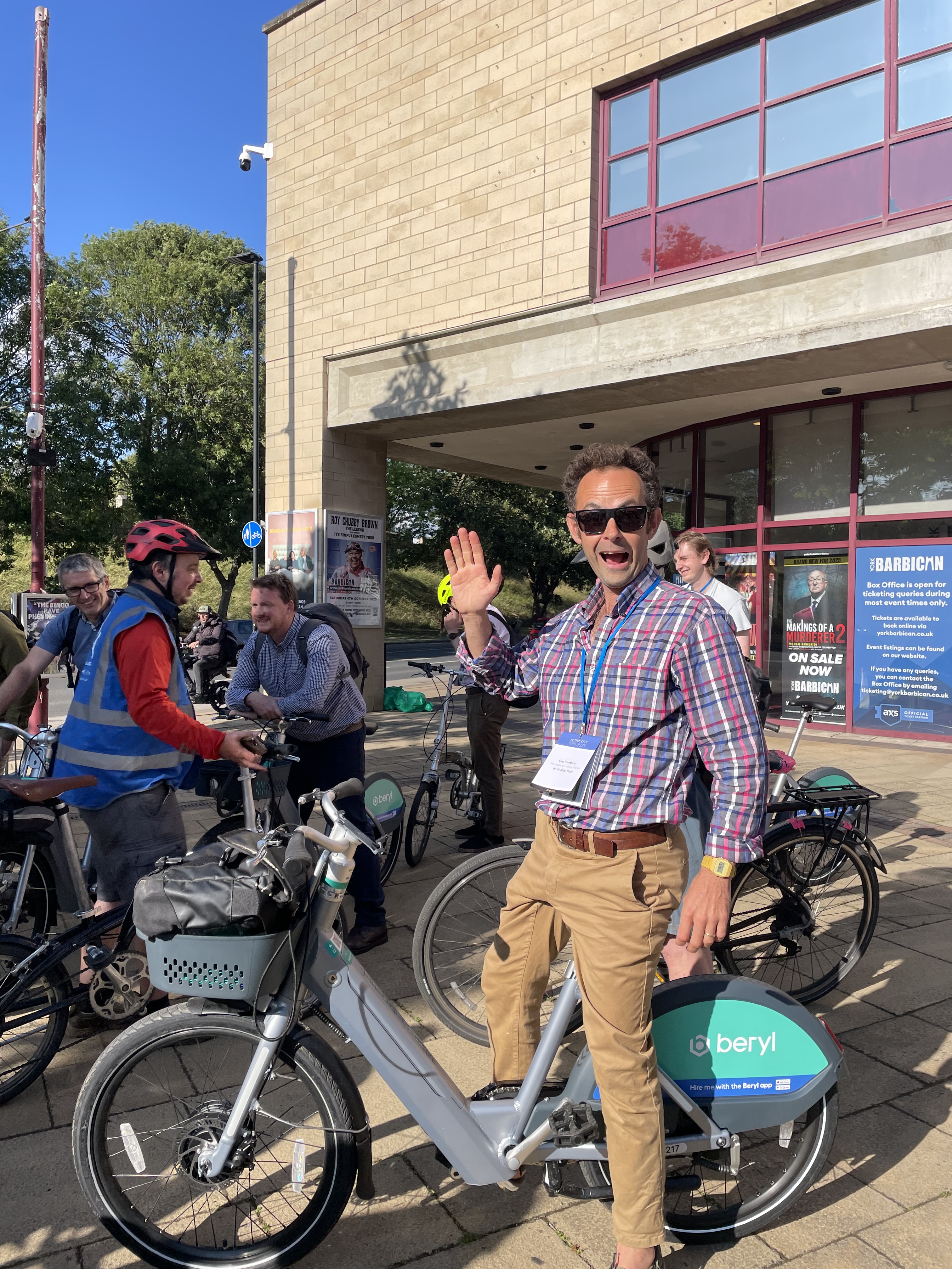
We have just had the Evil Cycling Lobby Annual Meeting Active City 2025 in York, which is when politicians, council officers and activitists get together to hear from the big dogs and share experiences. And the two big dogs this year were Chris Boardman – Commissioner of Active Travel England (he also won some Olympic Golds) and Chris Whitty – Chief Medical Officer for England (yes, that Chris Whitty). And the message was crystal clear to be honest. Our focus should be on:
Safe routes to schools
The basic calculation is this: no narrative is perfect, but one of the hardest to argue against is that kids should be able to walk, wheel, scoot and cycle to school in safety. It also genuinely delivers benefits to parents and carers if they can claw back ‘school run’ time for other activities.
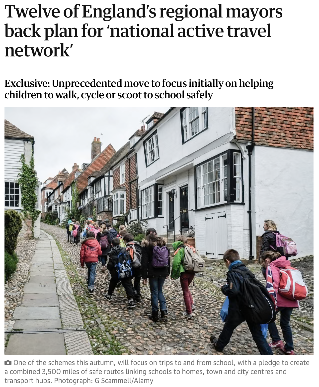
This commitment was underlined by a statement of intent from all but one regional mayors, including Helen Godwin (Labour) the new mayor of the WECA. The Guardian ran a full article with the details.
This will not translate immediately into how BANES prioritise schemes, but schools do already feature heavily in planning as you will see. Let’s have a quick run through what we know as of early July 2025…
Riverline Project
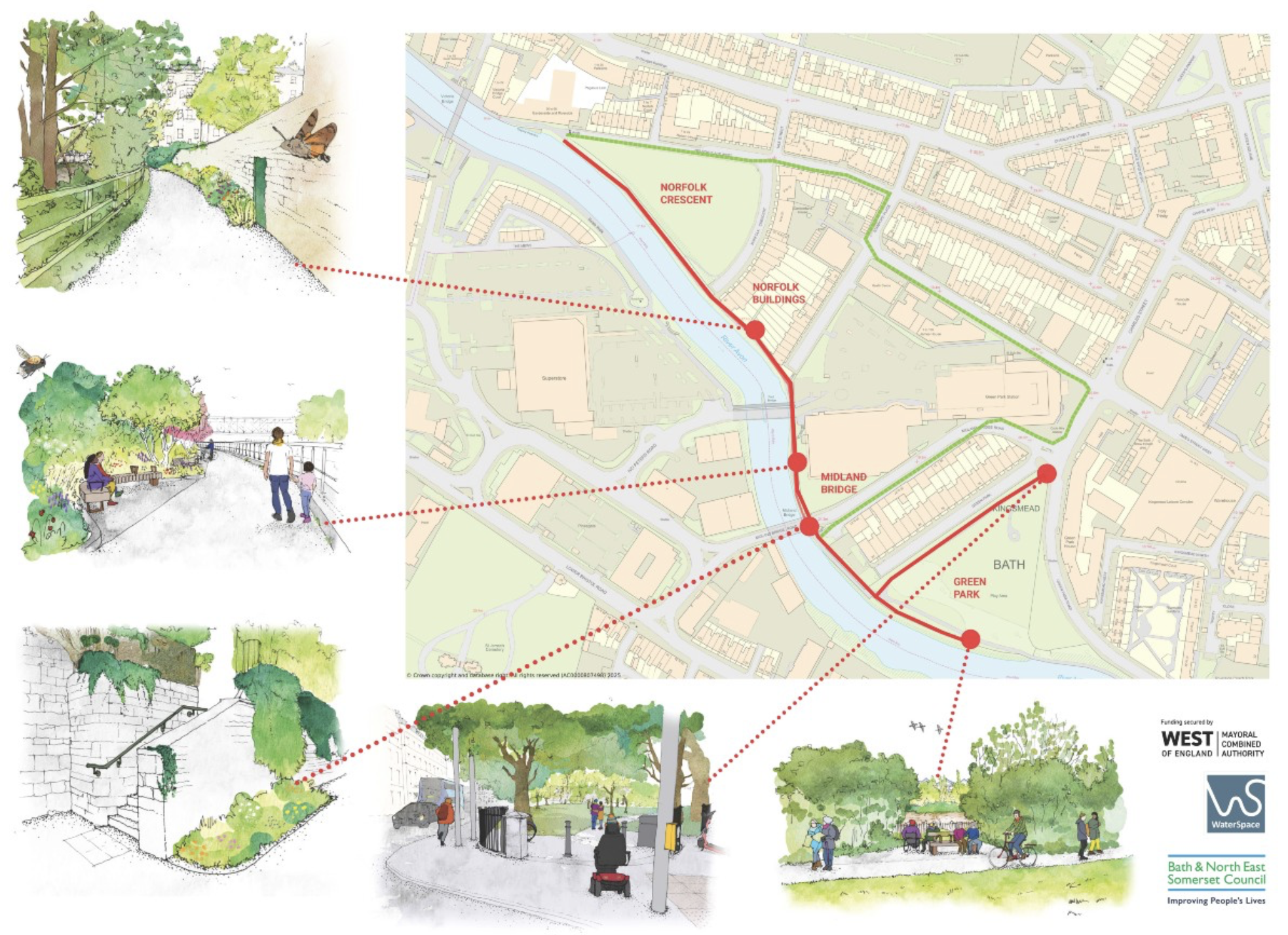
Although this thinks of itself more as a leisure route project, in the absence of safe alternatives (notably in the Windsor Bridge area) the river path remains the backbone east-west active travel. Some lovely work is starting to be delivered on pretty thin budgets- for instance, we finally have a sealed surface path in Green Park between the river and the road junction! The finish is sprayed chipping onto adhesive for those who take an interest in such things. Top work!
The river path already struggles to meet competing user demands at times. But in the absence of a plan for either the mothballed Locksbrook Railway bridge or Fieldings Bridge at Lidl, or indeed to extend the Upper Bristol Road enhancements westwards, we will have to make do with the basic setup we have for some time yet (at least another 5 years). So investment is gratefully received.


Bath Quays Links

This is a route connecting front of Green Park Station to Lower Bristol Road via the new river bridge.
As far as we know this is still funded and still progressing. TROs (Traffic Regulation Orders) have gone in, which is a prerequisite to work on the ground. So we may even see action later this year.
We are often told there is “no space” for cycling infrastructure as Bath’s roads are “too narrow”. However, there are many places such as the Lower Bristol Road in the location below that is far from the case. In fact, there is so much space ‘greedy stripes’ have to be installed in the middle of the road, greedy because the layout pushes pedestrians onto narrow pavements and provides no protected cycle lanes, whilst keeping acres of redundant tarmac in the middle of the road. And people complain about the carbon impact of 3m wide tarmac cycle lanes v. loose stone… (see the dire diagonal path in Victoria Park)

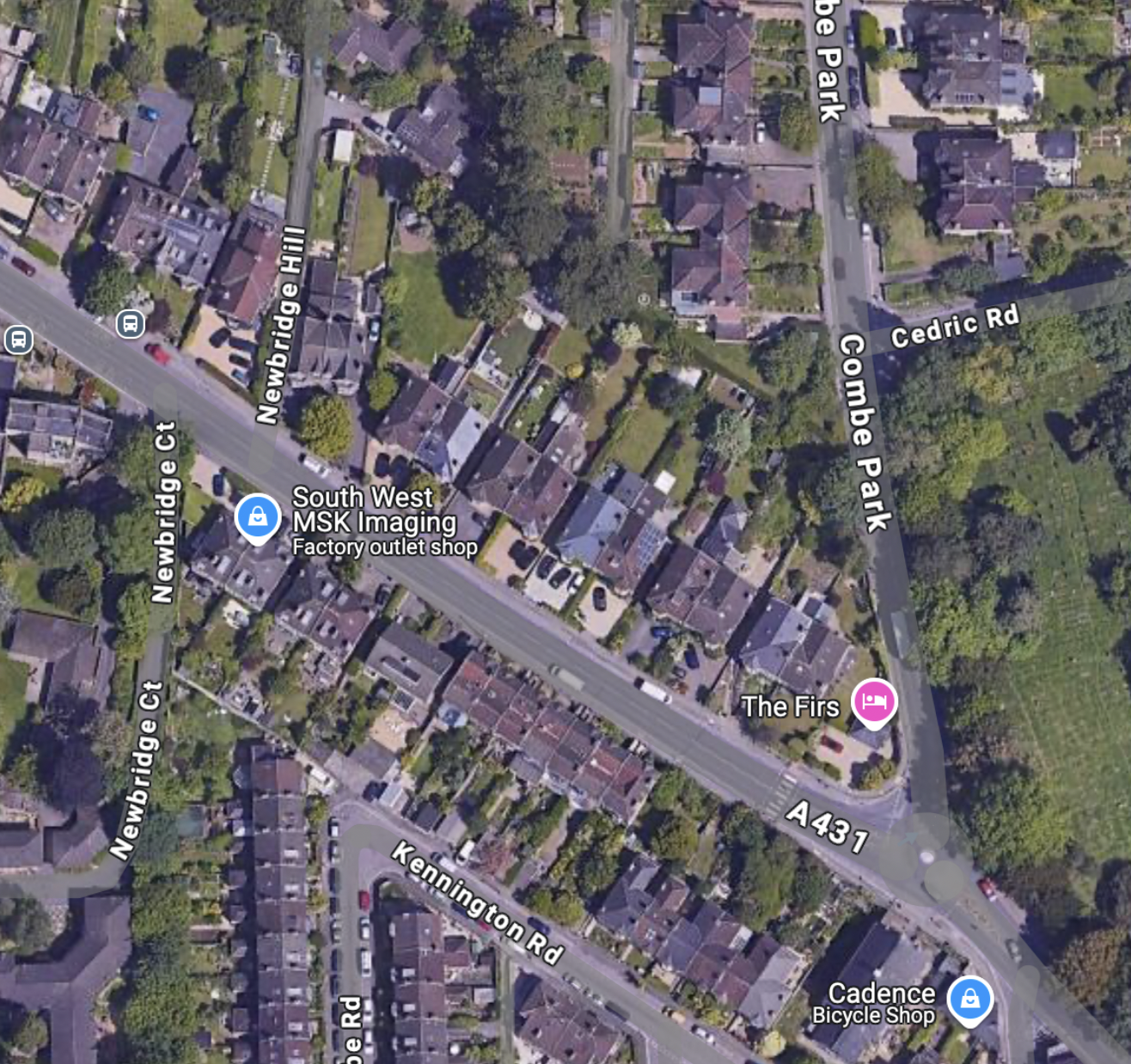
Newbridge Road is another place where we just can’t find any space for safe, affordable alternatives to driving…

Bath City Centre Project
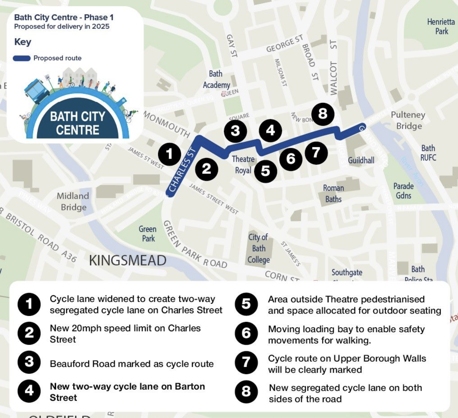
The ambitions of this scheme have been slimmed down a lot. It is basically now a slight shift of the east-west cycling corridor to Upper Borough Walls, recognising the fact Westgate Street is just a bit too congested at times with different modes of travel vying for space. A contraflow along the north side of the Guildhall will be particularly welcome.
One question mark is over Charles Street. Will there be a north-south connection between Monmouth Place and Bath Quay’s Link scheme at Green Park? We had been told no… initial drawings suggest otherwise.
Also, rumours swirl that Pulteney Bridge is in poor structural shape and all motor vehicles may have to be excluded entirely before long. Overall that would be a great thing for the public realm, although we could do with a bit more vision rather than just responding to events.
SCHOLARS WAY
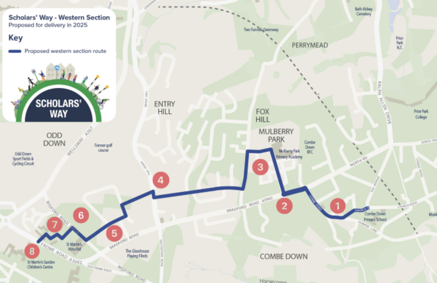
Good news on Scholars Way. Again, the TROs are in and the project has secured a large part of the funding required- well done to people who achieved that!
Hopefully we will see some work on the ground this year. Inevitably it will be a huge success in providing children with safe routes to school. Apparently we need ‘resilient children‘- well, giving them a bit of autonomy is not a bad thing surely? It can be good for parents and carers too. In places like the Netherlands, having to spend an hour a day on the ‘school run’ is an alien concept. That is a big time saving over the course of years!
Bath walking, wheeling & cycling links
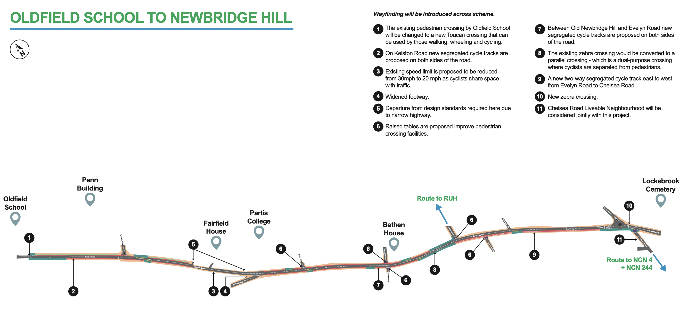
All gone a bit quiet on this one. The most exciting element of the project was the proposed Kelston Road cycle lane, giving a safe route to school for pupils at Newbridge Primary and Oldfield School.

The usual grumblings have been heard around people losing their free car storage on the highway, but given most homes have adequate off street options (driveways mainly but also end of garden parking accessed by side roads and back lanes) there seems a good chance of this progressing.
A4 Corridor programme

It seems fair to say relations between BANES and WECA (or more specifically, between leaders) has been utterly acrimonious under the former mayor.
No one location has shown this more than the Keynsham bypass. Despite the VAST expanse of tarmac, there is apparently not enough space for a 3m bidirectional cycle lane. This scream out a lack of lateral thinking- would there be space if the speed limit was cut to 40mph for instance (with negligible impact on journey times)?
WRB does not generally touch buses, but I will make an exception to say having the high frequency X39 skip one of the biggest conurbations on its route makes no sense. So when a proposal comes along to connect your community, grab it with both hands and accept that any project requires some compromises.
The new WECA mayor seems genuinely interested in building a more collaborative organisation, with Kevin Guy (BANES Council Leader) being the first rotating Deputy Mayor. Let’s hope something good can be salvaged from the wreckage at Keynsham- though it probably won’t include anything for people walking and cycling.
Liveable Neighbourhoods (LNs)
The programme is limping to a conclusion. Given the amount of noise and political & emotional capital invested in justifying the plans, it is surprising to step back and reflect how few neighbourhoods genuinely ended up as more liveable, which I shall take to mean safe for children to play outside their own home and walk/wheel/scoot/cycle to school through.
Essentially, if a modal filter (planters, bollards etc) is not implemented the core aim of making an area child safe is not achieved. Measures in isolation such as zebra crossing, are very expensive and do not actually tackle the root cause of danger- vehicle drivers. Most recently, is has been decided to maintain the Pulteney Estate as a through traffic route for drivers seeking to avoid waiting in turn to cross Cleveland Bridge (usually via St John’s Road). This is very disappointing.
There are a lot of things to learn from how LNs were rolled out. Probably the most notable is you can ask people their issues, but the average resident is not a public health expert or a traffic engineer. The implementation of a modal filter IS THE CONSULTATION and it takes years for people to adjust to. Yet representative polling shows these schemes are popular (around 75% people happy even in relatively short 6 months period after implementation). Show me any council policy where there aren’t 10% outraged by it- REMEMBER WHEN WHEELIE BINS WERE INTRODUCED?!
All in all, the LN programme scores 4.75/15 on the basis of whether a genuine ‘child safe’ area was created (have to deduce 1/4 for not filtering Sion Road, soz!). Which probably falls into the ‘could do better’ category. And for my money, the Circus Area is the stand out scheme. If only we could have done more… but still, thanks to those politicians who have stuck it out to deliver for the children of Bath.

And the rest…
School Streets… we are desperate to see these. Money has been allocated. Schools are apparently on board. More news should follow soon. One take away from elsewhere is volunteers ‘manning the barricade’ gets you so far (6 months?) but camera enforcement is essential longer term.
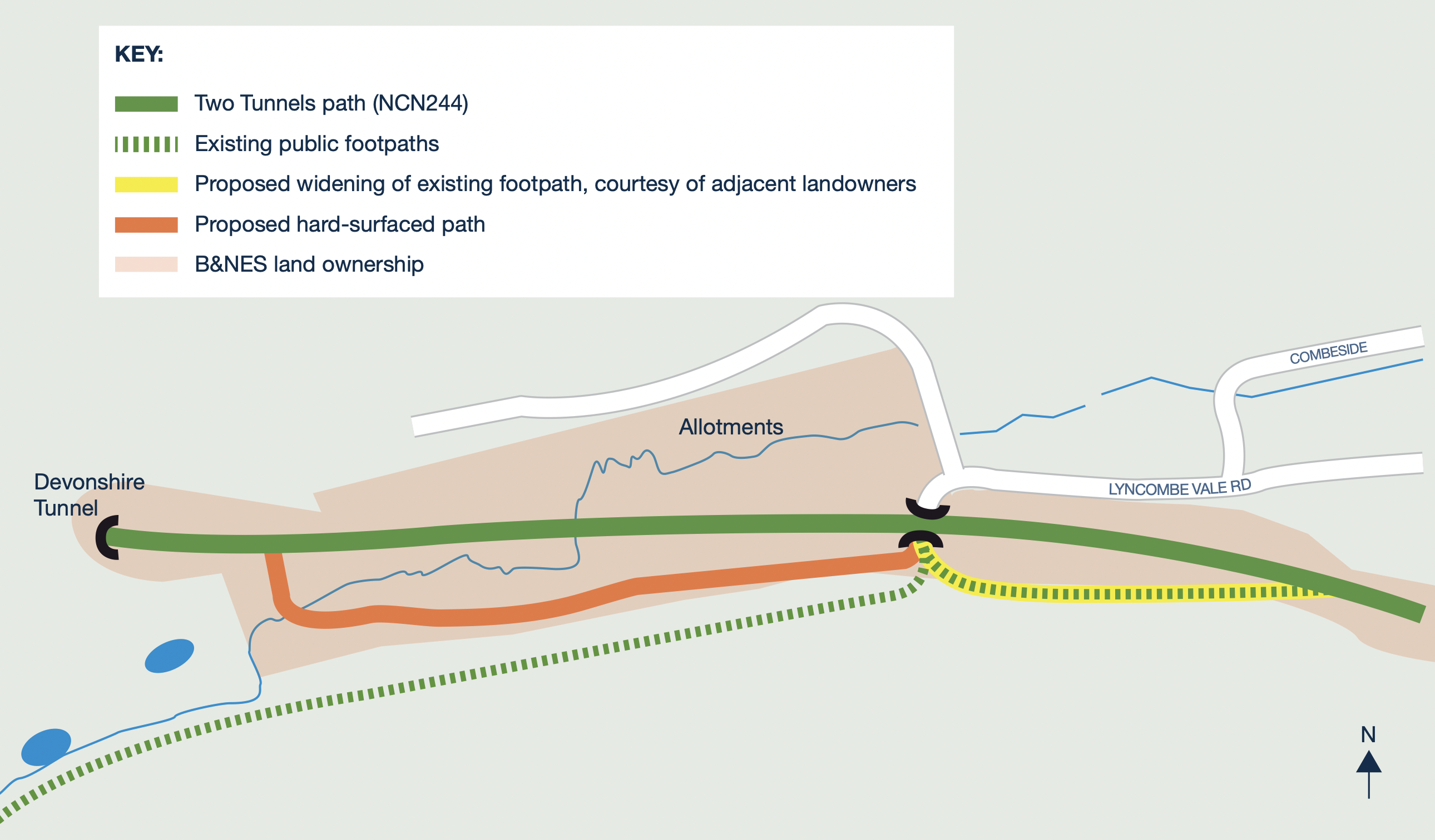
Lyncombe Vale – 2 Tunnels connection for all… outline plans have been drawn up identifying routes and a consultation has come and gone… but no funding as yet.
General removal of discriminatory barriers from Public Rights of Way… we did a lot of work on this in Weston and Newbridge. Happy to advise if anyone elsewhere wants to work to open up routes to all users elsewhere in Bath.
One win, and it has been in for a while now, was the removal of the gate at Lyncombe Vale. So a little firework for that 🎆

Canal Tow Path... work was supposed to have begun between Widcombe and Bathwick Hilll, but everything came back more expensive than expected (a bit of a theme tbh) so think the Canal and River Trust were trying to find some extra money
National Trust Bathampton Meadows… no update at the moment. But hoping for big things!
Bristol Bath Path eastward extension to Station Road Newbridge… well, nothing clear. It could be a winner if other schemes stall and they need to spend money. That said, it is getting a bit late to draw up plans.
20mph city… slow movement on this. The juxtaposition of every parish around Bath (rightly) demanding 20mph whilst the likes of Lower Bristol Road (LBR) remains 30mph grows starker every few months. Most recently Corston has had a safety upgrade to 20mph. Frustrating when we consider the bustling pavements around the likes of Lidl and opposite the Bath Press Development
Private developers delivering active travel routes… movement at the Gas Works site between the river and LBR. This will ultimately deliver an important east-west traffic free route. Nothing at the former Hartwell’s garage though.
Fieldings Bridge (Lidl river bridge)… the level of congestion here would be a source of outrage if it impacted drivers. Shockingly, there is nothing in the works to replace this bridge or indeed renovate the comparatively enormous Locksbrook former railway bridge.
Expansion of Dott shared bikes/scooters… the scheme appeared to be going through a rough patch with no progression anywhere for a good year. However, recently things picked up with the scheme expanding in Sth Glou. When will it cover all of Bath? The best we have is there will be more areas of WECA covered ‘later this summer’.
Dott on Linear Park… even when they do expand in south Bath, Dott remain banned from the core of the cycling network in the area, that being the Linear Park from the Two Tunnels to Lidl. Meanwhile, people can take illegal ebikes and private (illegal) escooters on the path unchallenged. Banes really need to sort this out and give access to legitimate users.
Expansion of residents parking… if a visitor chooses to drive, they need somewhere to park. Every extra vehicle on the road is additional safety risk making walking and cycling even less appealing. But as things stand, thousands of free on-street parking spaces remain, notably around the RUH. And there is no suggestion that this subsidy to drivers will be changing soon.
Cycle hangers… just a huge success. The latest tranche are filling up. All we can say is “more please”
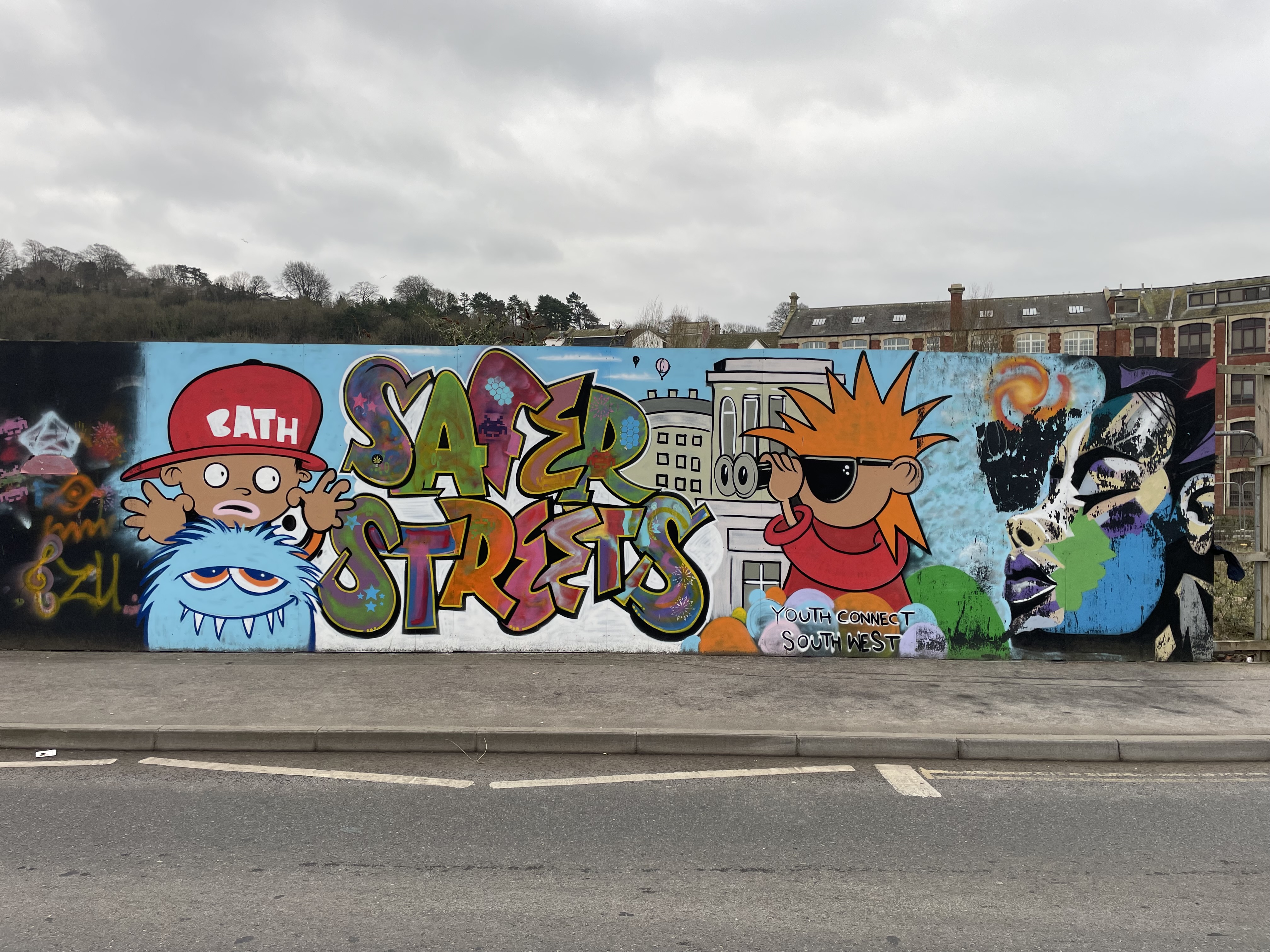
And finally… a nice bit of graffiti art near the old Avon Street multi-story. They are referring to personal safety, but I would say the more ‘eyes on the street’ there are through people walking, wheeling and cycling, the safer our city will be from many different perspectives.
Happy summer to all!